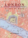
London: A Life in Maps
by Peter Whitfield
208 pages· 2007· ISBN 9780712349185
About
A city long shrouded in literary and historical mists--not to mention real ones--London seduces tourists and natives alike. From Big Ben to the grimy Victorian streets of Dickens novels on up to the sleek high-rises that dot the skyline of the twenty-first-century metropolis, the urban landscape of London is steeped in history, while forever responsive to the changing dictates of progress, industry, and culture. In London: A Life in Maps, acclaimed historian Peter Whitfield reveals a wealth of surprising truths and forgotten facts hidden in the city’s historic maps.
Whitfield examines nearly 200 maps spanning the last 500 years, all of which vividly demonstrate the vast changes wrought on London’s streets, open spaces, and buildings. In a rich array of colorful cartographic illustrations, the maps chronicle London’s tumultuous history, from the devastation of the Great Fire to the indelible marks left by World Wars I and II to the emergence of the West End as a fashion mecca. Whitfield reads historic sketches and detailed plans as biographical keys to this complex, sprawling urban center, and his in-depth examination unearths fascinating insights into the city of black cabs and red double-deckers. With engaging prose and astute analysis he also expertly coaxes out the subtle complexities—of social history, urban planning, and design—within the rich documentation of London’s immense and constantly changing cityscape.
London: A Life in Maps lets readers wander through the past and present of London’s celebrated streets—from Abbey Road to Savile Row—and along the way reveals the city’s captivating history, vibrant culture, and potential future.
Whitfield examines nearly 200 maps spanning the last 500 years, all of which vividly demonstrate the vast changes wrought on London’s streets, open spaces, and buildings. In a rich array of colorful cartographic illustrations, the maps chronicle London’s tumultuous history, from the devastation of the Great Fire to the indelible marks left by World Wars I and II to the emergence of the West End as a fashion mecca. Whitfield reads historic sketches and detailed plans as biographical keys to this complex, sprawling urban center, and his in-depth examination unearths fascinating insights into the city of black cabs and red double-deckers. With engaging prose and astute analysis he also expertly coaxes out the subtle complexities—of social history, urban planning, and design—within the rich documentation of London’s immense and constantly changing cityscape.
London: A Life in Maps lets readers wander through the past and present of London’s celebrated streets—from Abbey Road to Savile Row—and along the way reveals the city’s captivating history, vibrant culture, and potential future.
Discuss London: A Life in Maps with other readers
Join or start a book club for London: A Life in Maps on Readfeed. Live chat, shared reading progress, and AI discussion questions — free to get started.
Frequently asked questions
How do I join a book club for London: A Life in Maps?
Sign up free on Readfeed, then browse public clubs or start your own club with London: A Life in Maps as the current read. Invite friends with a share link and discuss together with live chat and AI discussion questions.
Can I discuss London: A Life in Maps with other readers online?
Yes. Readfeed book clubs let you chat live, share progress, and join discussions about London: A Life in Maps with readers worldwide — whether your club is virtual, in-person, or hybrid.
Is Readfeed free?
Yes. Creating an account and joining book clubs is free. Sign up to find readers who love the same books and start discussing today.